1- 1983: Neighborhood plan for Historic Sandy.
2-1987:The University of Utah and the American Institute of Architects worked together in the community design center, Assist Inc., and produced a "Main Street Study".
3-1990:Update to plan undertaken by students of Brigham Young University Institute of Public Management. The result was a report entitled "Recommendations for the Development of Historic Sandy".
4-1994:Richard Chong and Associates reviewed the master plan for the Main Street and Center Street area in light of what was going on in the Civic Center area.
5-1998:Sandy City completed a neighborhood plan for Historic Sandy that has been in place until the revised plan was adopted in October 2006.
The purpose of the 2006 Historic Sandy Neighborhood Plan was to present a comprehensive plan that guides the future development for the Historic Sand Neighborhood. The existing development in the study area (see map of Historic Sandy) has been guided by the previous neighborhood plan adopted in 1998. The planning staff began the process of updating this plan in 2005.
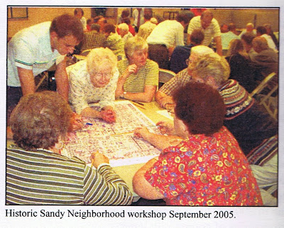
The process began with a series of community input workshops facilitated by Envision Utah. The workshops encourage the involvement of residents of the area in the planning process. At these workshops a series of maps were created by residents, property owners, business owners and other key stakeholders.
The resulting maps illustrated the desire for certain types of development patterns and land uses in the area. As dominant themes arose they were paced in one concensus map of the area. A Visual Preference Survey was also taken by those attending the workshop. The survey guided participants to evaluate the visual preferences of four different planning categories which included retail streetscapes, retail buildings, residential streetscapes, and residential buildings. This survey was used to help form the recommendations and design guidelines used in the 2006 neighborhood plan.
General recommendations obtained from the workshop included:
1-Provide efficient and expanding transportation options that balance auto convenience with walkability.
2-Encourage land uses that are compatible with the existing adjacent land uses and complements the character of Historic Sandy.
3-Integrate land uses with the existing and proposed transportation infrastructure.
4-Encourage economic growth and development through neighborhood oriented businesses.
5-Encourage expanded housing choices and additional affordable housing opportunities.
6-Create a transition between the mixed use district and single family neighborhoods.
7-Encourage the preservation and expansion of open space and trail networks.
8-Use of design guidelines as new development occurs in the neighborhood.
9-Preserve and integrate existing neighborhoods to help stabilize the Historic District.
10-Provide greater connectivity between existing and proposed land uses, creating a walkable district that is an asset to surrounding neighborhoods.
11-Encourage expanded service oriented business uses and other opportunities for local residents and employees.
This new neighborhood plan is a long-term vision for the Historic Sandy Neighborhood area. The city is planning a phased approach to implementation of the new pan to help satisfy the current needs of the area while preserving the viability of the communities future. short-term implementation will focus on the the areas that are undeveloped or underdeveloped.
